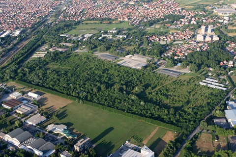
Photo update time! And I’m very happy to be able to bring you this one, as this is something I had wanted to do ever since I snooped around what was left of Borongaj airfield back in March :). And thanks to a free 9A-DDD, some beautiful (pre-storm) weather and my trusty fellow pilot Šime Plepelić I now bring you – Borongaj from the air!
A detail I neglected to mention the last time is that the field lies practically along the standard panorama route – and I’ve been flying by it for the past seven years without noticing (the problem was that before I actually hit upon the idea of using Google Earth, I thought the field was in the center of the Borongaj district, round a tram terminus). Now its location was blindingly obvious, so on yesterday’s flight with the guys, I decided we could just as well do a small detour… 🙂
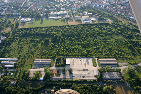
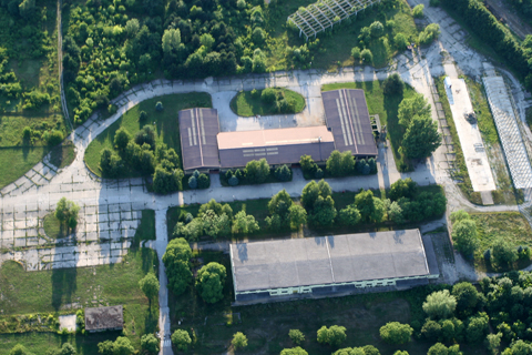
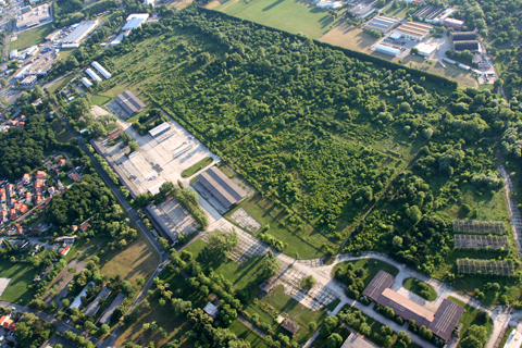
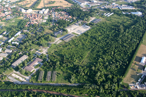
Passing by as we would normally do, just a bit closer. As you can see, Google Earth doesn't lie 🙂Turning round by 180 degrees brought us alongside the main apron, heading north for some photoreconnaissance of our own :). Deviating a bit from the norm, I was taking the photos from the left seat through the open window, while Šime was flying briefly from the rightA wider view of the main apron. From this vantage point, you can appreciate the difficulty of finding the runway...The northern end. The large building at the bottom is what I believe the hangar from WW2 (the one from the G.50 shot)Quarterview showing (almost) the entire taxiway complex. I had first entered the field via the access path visible at the bottom of the shot, right by the blocky apronIMO the best shot of the day :). Turning back to our route, we passed the north of the field, allowing for a full-view shot